The Scioto County Storm Chaser Center is a nonprofit organization established on August 22, 2005. It was created to provide reliable weather information to the residents of Scioto County, Ohio, as well as surrounding counties. These include Adams, Jackson, Lawrence, and Pike Counties in Ohio, and Carter, Greenup, and Lewis Counties in Kentucky. Our goal is to deliver the most accurate and timely weather updates available from the National Weather Service offices in Wilmington, Ohio, and Charleston, West Virginia.

We offer a wide range of weather resources to the community. These include National Weather Service forecasts, local and regional radar imagery, and current Watches and Advisories. We also provide Children’s Safety Guides, Owlie’s Weather Safety materials, Adult Safety Guides, and general Weather Guides. In addition, we share SkyWARN training schedules for both Wilmington, Ohio, and Charleston, West Virginia. Our website features links for School Delays & Closings from WSAZ News Channel 3, WBNS News Channel 10, WKRC News Channel 12, WKYT News Channel 27, and WOWK News Channel 13. Visitors can also access online radio station links, weather camera feeds from the Ohio Department of Transportation, and weather app recommendations for mobile devices. A dedicated Sponsors & Partners page and viewer testimonials are also available.

You can follow the Scioto County Storm Chaser Center on Facebook, where we post Advisories, Watches, and radar updates during severe storms. We also share the Weekly Forecast from the National Weather Service office in Wilmington, Ohio. Stay connected by visiting https://www.facebook.com/SCSCC45662OH and clicking "Like".

Facebook Users: Please use #OHWX to report Storms in Ohio and use #KYWX to report Storms in Kentucky.

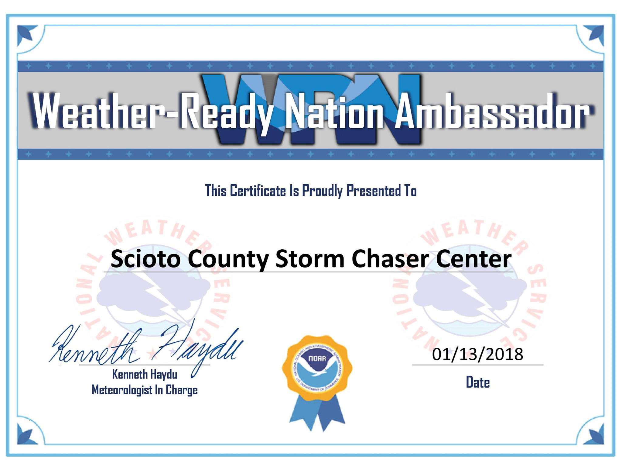
 Scioto County Storm Chaser Center became a Weather-Ready Nation Ambassador 
 with the NOAA (National Oceanic and Atmospheric Administration)/NWS (National Weather Service) 
 on January 13th, 2018.
 

Weather-Ready Nation Ambassador Certificate

US FEDERAL
OHIO
KENTUCKY
WEST VIRGINIA
SCSCC Radar BR
CLICK HERE TO VIEW PURPLRAIR LOCAL AIR QUALIY SENORS
Tornado Risk Map

WSAZ - Portsmouth Ohio Weather Cam - CLICK HERE
WSAZ - Portsmouth Ohio Weather Cam
WSAZ - 7 Day Forecast, Huntington, WV - WSAZ Weather
WSAZ 7 Day Forecast
WKRC - 7 Day Forecast, Cincinnati, OH - WKRC Weather
WKRC 7 Day Forecast
WKYT - 7 Day Planner, Lexington, KY - WKYT Weather
WKYT 7 Day Forecast
NWS Wind Chill Index Chart
NWS Heat Index Chart
NWS Heat Disorders
NWS Dew Point Comfort Range
The Beaufort Wind Scale

Force Name

 Wind Speedknots       mph

Consequence
0 Calm 0 0 Smoke rises vertically

Wave height: 0 m - Sea: Like a mirror

1 Light Air 1-3 1-3 Smoke drifts with air

Wave height: 0.1 m (.25 ft) - Sea: Ripples - No foam crests

2 Light Breeze 4-6 4-7 Weather vanes become active

Wave height: 0.2-0.3 m (0.5-1 ft) - Sea: Small wavelets - Not breaking

3 Gentle Breeze 7-10 8-12 Leaves and small twigs move

Wave height: 0.6-1 m (2-3 ft) - Sea: Small wavelets - Crests begin to break

4 Moderate Breeze 11-16 13-18 Small branches sway

Wave height: 1-1.5 m - Sea: Small waves becoming longer, numerous whitecaps.

5 Fresh Breeze 17-21 19-24 Small trees sway - Waves break

Wave height: 2-2.5 m (6-8 ft) - Sea: Moderate waves - Many whitecaps

6 Strong Breeze 22-27 25-31 Large branches sway

Wave height: 3-4 m (9.5-13 ft) - Sea: Larger waves forming - Whitecaps everywhere

7 Near Gale 28-33 32-38 Whole trees sway - difficult to walk

Wave height: 4-5.5 m (13.5-19 ft) - Sea: Sea heaps up - White foam blown around

8 Gale 34-40 39-46 Twigs break off trees

Wave height: 5.5-7.5 m (18-25 ft) - Sea: Edges of crests break into spindrifts

9 Strong Gale 41-47 47-54 Shingles blow off roofs

Wave height: 7-10 m (23-32 ft) - Sea: High waves - Sea rolls - Reduced visibility

10 Storm 48-55 55-63 Trees uprooted - Damage to buildings

Wave height: 9-12.5 m (29-41 ft) - Sea: Very high waves with overhanging crests

11 Violent Storm 56-63 64-73 Widespread damage

Wave height: 11.5-16 m (37-52 ft) - Sea: Exceptionally high waves

12 Hurricane Over 63 Over 73 Violent destruction

Wave height: 16+ m (52+ ft) - Sea: Sea completely white - Excessive foam